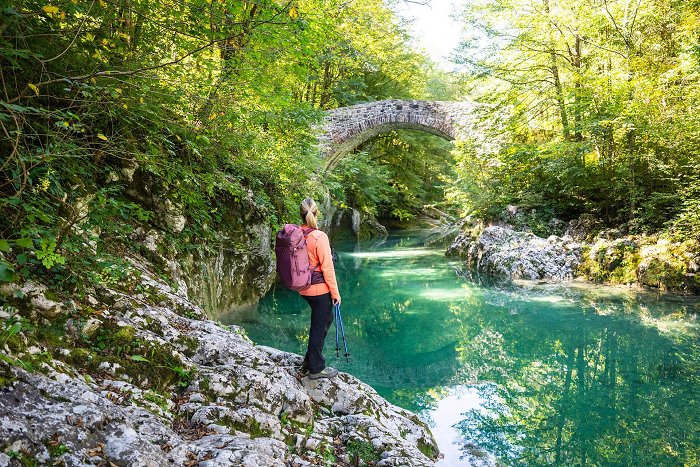
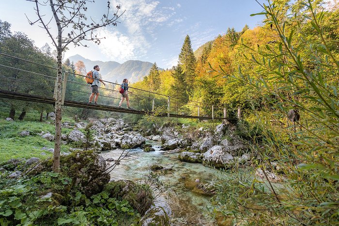
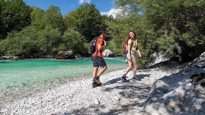
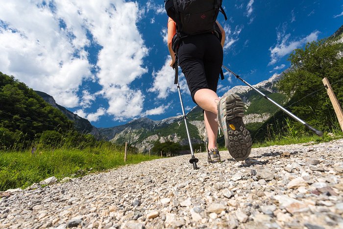
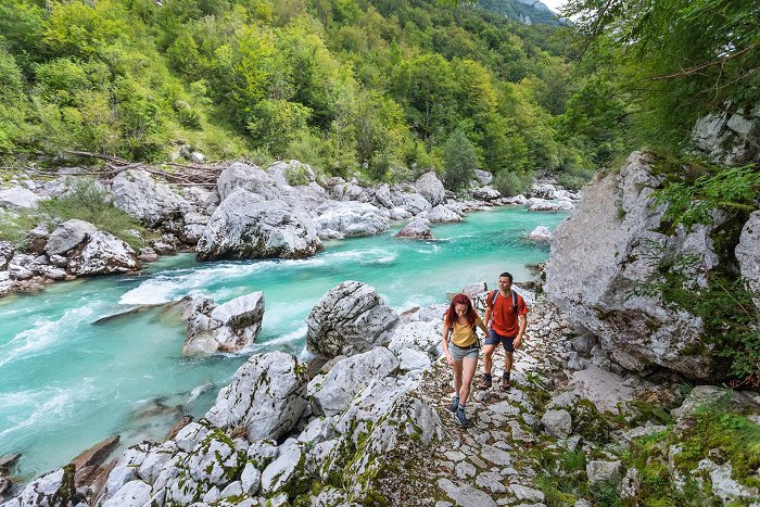
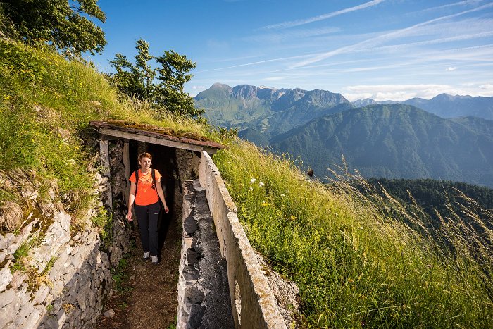
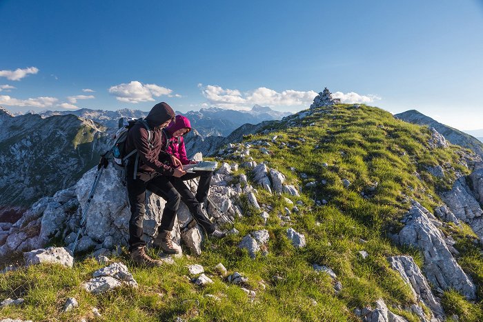
The mountainous world of the Julian Alps, the pristine nature of the Triglav National Park and the refreshing Soča river make Soča Valley one of the most beautiful hiking destinations.
The hiking trails boast magnificent views of streams and waterfalls, quiet Alpine forests, and a wide range of plants and animals that live in what many people consider the most beautiful part of the Julian Alps.
The marked trails of varying levels of difficulty are suitable for advanced mountain hikers and climbers as well as visitors looking for a pleasant walk and a way to see some of the easily accessible natural wonders and cultural sights.
Before you go to the mountains, read the instructions for safe hiking.
14 chapels of the Sections of the Cross
Theme trail | easy
Mt. Mengore, visit to the Church where the rebels used to gather
3.3 km
219 m
1:15 h
219 m
Big Gorge of the Soča river
Alpe Adria Trail
Pred parkiriščem na planini Kuhinja je odcep poti proti Mrzlemu vrhu
From the Kuhinja Mountain pasture towards the Pretovč Mountain pasture
Zasavska koča na Prehodavcih Mountain hut and Mt. Razor in the background
Mountain tour | difficult
Three-day hiking tour to the Triglav Lakes and Mt. Krn (2244 m)
44.2 km
3003 m
20:32 h
3096 m
Above the Zapleč Mountain pasture towards the Vrata Mountain pass
Mountain tour | moderate
Historical ridge trail from the Vrata Mountain Pass to Mt. Vršič (1897 m)
11.8 km
1220 m
6:03 h
1220 m
Vzpon na Bavški Grintavec
Mountain tour | difficult
Tour to Mt. Bavški Grintavec from the village of Soča (2347 m)
11.3 km
1801 m
7:14 h
1801 m
On the Razor Mountain pasture
Back-country skiing | difficult
Mt. Rušnati vrh (1915 m), a stubby summit above the Razor Mountain pasture
9.2 km
1019 m
4:02 h
1019 m
Mt. Kolovrat Highway
Hiking trail | easy
Mt. Kolovrat, a magnificent panoramic hill above the Soča Valley
8.6 km
264 m
2:50 h
264 m
Prihod v Tolminske Ravne
Počitek v Čezsoči
Gorsko kolesarjenje
On the Mangart Mountain pasture
Back-country skiing | difficult
Mangart Mountain pass (2072 m) – spring skiing beneath the mighty mountain
10.5 km
991 m
3:45 h
991 m
Izhodišče poti v kraju Brezje
Hiking trail | moderate
From the village of Montemaggiore (Brezje) to the spring of the Nadiža River (Rio Bianco (Beli Potok))
7.0 km
477 m
5:09 h
475 m
Tura se začne na mejnem prehodu, od koder sledimo kolovozu v dolino
Hunting lodge on the Goričica Mountain pasture
Mountain tour | moderate
Circular hiking trail to the Goričica Mountain pasture
10.8 km
915 m
5:17 h
914 m
From Mt. Prestreljenik to the Velika Črnelska špica peak and the foothills of Mt. Rombon
Podbrdo Trail Running Festival Marathon
Trail running | difficult
Julian Alps: Podbrdo Trail Running Festival Marathon
39.7 km
2965 m
12:00 h
2961 m
Zaprikraj, Outdoor museum of the First World War
Petrinova žaga na začetku poti nad Breginjem
Mountain tour | moderate
Streams Črni potok and Rio Bianco (Beli potok) beneath Mt. Breški Jalovec (Punta di Montemaggiore) where the Nadiža River springs
9.0 km
693 m
4:38 h
693 m
Znamenje pred Strmcem
Hiking trail | moderate
Hiking along the trails “Lončarska” and “Po mostiču”
4.9 km
298 m
1:57 h
297 m
Krn
Bicycle Ride | moderate
Cycling from Kobarid to the Kuhinja Mountain pasture
12.7 km
840 m
2:56 h
101 m
Along the trail to Mt. Mrzli vrh
Mountain tour | moderate
Mt. Mrzli vrh (1359 m), a steep ascent from the village of Zatolmin
12.5 km
1159 m
6:21 h
1159 m
Virje waterfall
Towards the Leskovca Mountain pasture
Mountain tour | moderate
Tour from the Kuhinja Mountain pasture to Mt. Visoc vrh (1482 m)
19.1 km
1025 m
8:16 h
1035 m
Start of the trail to Mt. Žabijski vrh
Mountain tour | moderate
Ascent on Mt. Tolminski Triglav (1141 m) via Mt. Zabijski vrh (775 m)
10.1 km
880 m
4:52 h
880 m
Signs before the start of the trail to the waterfalls
Hiking trail | difficult
Brinta Waterfall and Gregorčič Waterfall – hidden sights above the village of Selce
3.0 km
279 m
1:20 h
279 m
Brjeka footbridge.
Mt. Meja rising behind the ridge which also leads towards Mt. Rušnati vrh
Na poti od Mosta na Soči do Klavž
Bicycle Ride | moderate
Tour across the Šentviška planota Plateau – an oasis of peace and beauty
32.3 km
641 m
4:05 h
641 m
Mt. Čisti vrh with Mt. Triglav and Mt. Kanjavec in the background
Snowshoeing | difficult
Mt. Čisti vrh (1875 m) above the Trenta Valley – a wonderful sightseeing hill
16.3 km
847 m
7:02 h
850 m
Soča Trail sign
Theme trail | moderate
Along the Soča River through the Kobarid Gorge to the village of Magozd and the Kozjak Waterfall
8.1 km
294 m
3:09 h
294 m
On the Slapnik Mountain pasture
Mountain tour | moderate
Mt. Kožljak (1578 m) – a botanically and historically interesting summit in the shade of Mt. Krn
8.1 km
906 m
4:41 h
906 m
S parkirišča sledimo smernim tablam
Mountain tour |
Mt. Matajur (1642 m), a boundary mountain between the Republic of Slovenia and Italy
10.7 km
824 m
4:56 h
828 m
Pot iz Robidišča poteka sprva po neobljudenem planotastem terenu
Mountainbiking | difficult
E-cycling to Mt. Joanaz (Ivanac) – the junction of three worlds
21.6 km
555 m
3:31 h
553 m
Nadiža River beneath the village of Podbela
Bicycle Ride | difficult
Sightseeing cycling tour to the village of Robidišče
44.5 km
731 m
5:14 h
731 m
On the razor Mountain pasture
Back-country skiing | difficult
Mt. Vrh Krnic (1896 m), an indistinct peak between Mt. Vogel and the Globoko Mountain pass
9.6 km
990 m
4:13 h
990 m
Začetna stezica skozi gozd
Mt. Vrh Laške Planje (left) and the Kaninski podi Plateau
Na planini Kuk, desno piramidast Žabijski Kuk
Mountain tour | difficult
Mt. Žabijski Kuk (1844 m) from the Kuk Mountain pasture
11.9 km
966 m
5:44 h
966 m
Above the edge of the forest with villages ni the Region of Veneto below
Mountain tour | moderate
Mt. Matajur (1642 m), a pleasant ascent from the Italian side of the mountain
6.3 km
633 m
3:16 h
632 m
Pomladni start
Edge of the forest, view of Mt. Črna prst
Mountain tour | easy
Mt. Porezen (1630 m), a quick and short tour from the Petrovo Brdo Mountain pass
7.7 km
542 m
3:33 h
542 m
Starting point at the Kuk Mountain pasture
Mountain tour | moderate
Mt. Vogel (1923 m), along the ridge above the Razor Mountain pasture
12.9 km
877 m
5:59 h
883 m
Road from the village of Livek to the village of Livške Ravne
Bicycle Ride | difficult
Mt. Kolovrat, along the panoramic road with views of the Soča Valley
35.4 km
1061 m
5:04 h
1052 m
Rombon in Jerebica
Grassy slopes of Mt. Stol in the spring and Mt. triglav in the background
Planinski dom Pod Ježo
Kolesarjenje Kobarid
The Trail Guardians
Roadmen house
Back-country skiing | difficult
Mt. Mali Razor (2191 m) – a little-known summit between Mt. Prisojnik and Mt. Razor
6.1 km
967 m
2:24 h
968 m
Grofova voda Spring
Zapleč and Zaprikraj Mountain pastures viewed from the trail towards the Vrata Mountain pass
Mountain tour | difficult
Mt. Srednji vrh (2134 m) and Mt. Krnčica (2142 m), two wonderful mountains of the Mt. Krn Mountain chain
11.9 km
1393 m
6:33 h
1400 m
Globoški potok waterfall
Mt. Krasji vrh
Mountain tour | moderate
Mt. Krasji vrh (1773 m), a mighty sightseeing hill above the Soča Valley
12.1 km
1023 m
5:54 h
1023 m
Along the snowless terrain to the first patch of snow
Back-country skiing | difficult
Mt. Krn (2244 m), a ski touring destination that rarely disappoints
10.3 km
1247 m
4:31 h
1247 m
Počitek v dolini Lepene
Sončni vzhod
Along the trail from the cottage at the source of the Soča RIver
Hiking trail | moderate
Zapotoški slapovi Waterfalls, natural sight in gable end of the Zadnja Trenta Valley
7.1 km
236 m
2:10 h
232 m
Bovec Basin
Hiking trail | moderate
Gozdec, a trip into the cool forests of Mt. Kanin
17.1 km
1746 m
7:23 h
1745 m
Top of Mt. Svinjak with the miniature tower
Mountain tour | moderate
Mt. Svinjak (1653 m), Mt. Matterhorn of the Bovec area
7.8 km
1285 m
4:56 h
1287 m
Pogled z B postaje na Bovško kotlino (začetek poti)
Mountain tour | moderate
The Kanin Mule Track – A Trace of History in the Kanin Forests
6.3 km
394 m
2:55 h
817 m
Jelenk - vrh
The tour starts at the military chapel in front of the village of Gabrje
Mountain tour | difficult
Circular trail across Mt. Grmuč (1196 m) and Mt. Vodil vrh (1053 m)
10.4 km
1031 m
5:34 h
1059 m
Most na Soči
Theme trail | easy
Čez most po modrost: a cultural-historical trail along Most na Soči
6.2 km
125 m
3:00 h
125 m
Bavšica valley
In front of the Idrska planina Mountain pasture
Cableway to Mt. Kanin
Mt. Veliki Babanski skedenj
Vrh Korade
Marijino Celje
Sončni vzhod na Črni prsti
There are two trails leading to the first destination - Bes Chapel and the Planica Mountain pasture
Last section of the trail and Mt. Triglav on the right
From the Kuhinja Mountain pasture to the Leskovca Mountain pasture
Mountain tour | moderate
Mt. Maselnik (1903 m), a sentinel in front of the entrance into the Lužnica Valley
9.7 km
883 m
5:00 h
883 m
Polog Mountain pasture
Zadnja Trenta Valley - Zapoden Valley
Snowshoeing | moderate
Snowshoeing in the Zapoden Valley (Zadnja Trenta Valley)
7.6 km
235 m
2:47 h
235 m
Fort Kluže
Above the Leskovca Mountain pasture
Mountain tour | moderate
Mt. Rdeči rob (1913) and Mt. Škofič (2013), two wonderful sightseeing hills above the Kuhinja Mountain pasture
11.3 km
1010 m
5:18 h
1010 m
Along the pasture above the first trough with drinking water
Mountain tour | moderate
Zaprikraj Mountain pasture and the Zaprikraj Outdoor museum – nature and history in one tour
8.7 km
558 m
3:57 h
558 m
Signs at the parking lot above the village of Avsa
Back-country skiing | moderate
Peaceful tour from Avsa to Mt. Matajur (1642 m) and Mt. Mrzli vrh (1358 m)
11.3 km
852 m
2:53 h
852 m
Rapids along the Šunik Water grove
Autumn view of Mt. Krn from Mt. Kolovrat
Mountain tour | moderate
Mt. Krn (2244 m) from the Kuhinja Mountain pasture
13.6 km
1343 m
7:27 h
1321 m
Morning in Bovec
The Bovec area
In front of the village of Drežnica
Hiking trail | moderate
Curk Waterfall – a 70-metre waterfall above the village of Drežniške Ravne
5.0 km
344 m
1:54 h
344 m
Gozdna cesta do planine
Top of Mt. Rombon (2208 m) on the left
Mountain tour | difficult
Mt. Rombon (2208 m), the finest sightseeing hill of the Bovec area
18.2 km
1763 m
8:10 h
1774 m
Tolminka gorge
San Antonio
Mountainbiking | moderate
E-cycling from Robidišče across Canebola (Čenebola) to Prossenicco (Prosnid) and back
23.7 km
604 m
4:07 h
608 m
A perfect location to view the valley
A wooden cross at the top of Mangart.
Proti lovski koči pri izviru Tolminke
Blick vom Kolovrat auf Tolmin und Soca Tal
Bovec panorama (Narnia)
Long distance hiking trail | moderate
ST25 AAT: Bovec - Drežnica (Kobarid)
22.0 km
627 m
7:15 h
545 m
Cycling, Napoleon's Bridge across the Soča River
Bicycle Ride | moderate
Circular cycling tour along the Soča River past the village of Drežnica to the village of Trnovo ob Soči
19.3 km
560 m
2:23 h
559 m
Del zavarovane poti na poti Silva Korena
Mountain tour | difficult
Along the Silvo Koren route to Mt. Krn (2244 m)
16.6 km
3349 m
10:42 h
1747 m
Smerne table nad parkiriščem Pri koritu, zavijemo proti planini Zapleč
Vrsic-Sattel
Kobarid Historical Trail, along the Soča River, Kobarid
Brv čez Sočo pri Jablanci
Mt. Kozlov rob and Tolmin viewed from Mt. Bučenica
Traditionelles Essen im Socatal
Long distance hiking trail | difficult
ST26 AAT: Drežnica (Kobarid) - Tolmin
21.9 km
771 m
8:00 h
1123 m
V steno uklesana pot poteka po strmih pobočjih Kolovrata
Hiking trail | moderate
Foni, a forgotten small village on the sightseeing balcony beneath Mt. Kolovrat
2.7 km
430 m
1:19 h
0 m
View of Mt. mangart from the Mangart Mountain pass
Mountain tour | difficult
Tour to the Mangart Mountain pass along the former shepherds’ trails
14.7 km
1367 m
7:39 h
1366 m
Boka Waterfall
Široko, Tolminska kotlina
Beri Waterfall
Vhod v kaverno brigade Avellino
Pogled od kapelice, kjer je izhodišče poti na Ivanac
Brücke über die Soča
Loška Koritnica Valley
Chapel of the Christ the Redeemer on the top
Back-country skiing | moderate
Mt. Matajur (1642 m), ski touring to the Italian side of the mountain
7.4 km
656 m
2:00 h
645 m
Memorial Church of the Holy Spirit in Javorca, European heritage monument
Trail running | moderate
Polog Mountain pasture, a popular local jogging trail
8.7 km
366 m
1:15 h
367 m
On the shady side along the riverbed of the Mlinarica Stream
Back-country skiing | difficult
Mt. Turn pod Razorjem (2348 m) – a skiing pearl in the Mlinarica Valley
7.2 km
1043 m
2:30 h
1043 m
Morning in Tolminske Ravne
Back-country skiing | moderate
Globoko Mountain pass and Mt. Rušnati vrh (1915 m)
10.8 km
1164 m
3:13 h
1189 m
Smerokaz pri parkirišču nad Drežniškimi Ravnami; gremo v smeri Krasjega vrha
Sunrise behind Mt. Porezen
Mountain tour | moderate
Mule trail 1932, old military trail beneath the peaks of the Tolmin Mountain chain
17.3 km
1019 m
5:00 h
1388 m
Levo Krn, desno naš cilj Batognica
Mountain tour | moderate
Mt. Batognica (2164 m), the closest neighbour of Mt. Krn
12.8 km
1128 m
6:53 h
1128 m
Waterfall in the Koseč Gorges
In front of the village of Drežnica
Bicycle Ride | moderate
Cycling to the villages of Koseč and Magozd with a dessert
12.8 km
384 m
1:47 h
384 m
Hiking trail | difficult
JULIANA TRAIL: stage 9 Podbrdo - Grahovo ob Bači
17.1 km
1010 m
6:30 h
1208 m
Hiking trail | moderate
JULIANA TRAIL: stage 10 Grahovo ob Bači - Most na Soči
16.7 km
776 m
4:30 h
919 m
Hiking trail | difficult
JULIANA TRAIL: stage 15 Log pod Mangartom - Tarvisio (ITALY)
20.6 km
767 m
4:15 h
659 m
Tolmin Gorges
The Tolmin gorges are the lowest and southernmost entry point into the Triglav National Park and Tolmin’s most important sight of nature.
download
The Kobarid Historical Trail
The Kobarid historical trail links places around Kobarid, where important historical, cultural and natural monuments can be seen. The trail is 5 km long.
download
Idrsko Historical Trail
The trail leads from the town of Kobarid along the cultivated fields, past the watery Idrija stream and through the village of Idrsko.
download
The Soča Trail
The Soča Trail (Soška pot), the first nature trail to be created in Triglav National Park runs along the Soča river from its source to the town of Bovec.
download
Waterfall Virje and the spring of Glijun
The secret trails of the Kanin karst waters.
download
Julian Alps
This publication includes images and texts introducing Alpine peaks and green hills, mysterious caves, and therapeutic water springs. Look through Alpine towns and villages, possibilities for an active holiday, tips for trips, culinary delights, and study a helpful map.
download